Guides
When should you stargaze in the American Southwest, with monsoon and smoke?
Monsoon cloud, wildfire smoke and the Milky Way core decide which month works in Arizona, New Mexico, Utah and Texas. Here is how to time a trip.
What to take away
- In Arizona and New Mexico the North American monsoon runs early July to mid September, so a clear summer night is a gamble and late September is the safer bet.
- Smoke can sit 300 miles from the fire and still wash out the Milky Way core under a cloudless forecast.
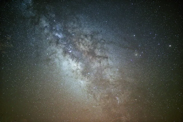
- The core is visible in the evening from May through early October, with the longest dark window in June.
- Book three nights minimum, and pick a backup site at least 60 miles away in a different microclimate.
- Confirm your site on a light pollution map before you drive; a dark county still has bright towns inside it.
What actually decides the night
Three things decide whether a Southwest night is worth the drive: monsoon cloud, wildfire smoke, and where the Milky Way core sits in the sky.
Three factors vs easy factors
Weather factors
- Monsoon cloud
- Weather
- Wildfire smoke
- Weather
- Milky Way core
- Weather
- Moon phase
- —
- Drive time
- —
Easy factors
- Monsoon cloud
- —
- Wildfire smoke
- —
- Milky Way core
- —
- Moon phase
- Arithmetic
- Drive time
- A choice
Everything else is easier. Moon phase is arithmetic. Drive time is a choice. Those three are weather, and weather is what turns a four-night trip into one good night.
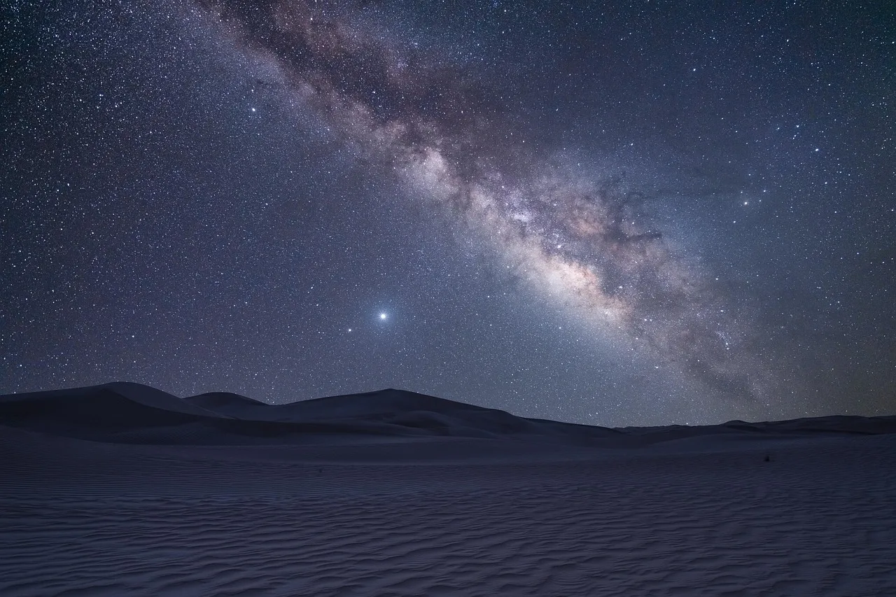
The core is the bright galactic center. It rises in the southeast and sets in the southwest, and its evening window shifts roughly two hours earlier each month from spring into fall.
If the core is your target, plan around a new moon or a moon that sets before the core clears the horizon. For how the seasons shape a whole trip, see what each season is good for.
Monsoon: the summer cloud machine
The North American monsoon is a seasonal wind shift that pulls moisture from the Gulf of California and the Gulf of Mexico. It starts in early July, peaks in July and August, and fades by mid to late September.
In Arizona and New Mexico, July and August together produce roughly 40 percent of the annual precipitation.
Monsoon season timing
- Early JulyMonsoon starts
- July–AugustMonsoon peaks
- Mid–late SeptemberMonsoon fades
- Late September–OctoberClear payoff
In Arizona and New Mexico it sets the summer pattern. Mornings run clear, clouds build after noon, and storms can linger past dark. A storm that never reaches your site still leaves cloud between you and the sky.
Terrain splits the difference. High ground triggers storms earlier; a basin 2,000 feet lower often stays clear an hour longer. On a marginal monsoon night, elevation works against you.
Storms also leave haze. Transparency can stay poor for an hour or more after the last cell passes, even when the sky looks clean.
Late September and October are the payoff. Moisture drops, skies clear, temperatures fall. For a core view with lower cloud risk, aim for the last week of September or the first half of October.
NOAA climate resources points to the National Centers for Environmental Information at ncei.noaa.gov and the Climate Prediction Center at cpc.ncep.noaa.gov. These track monsoon onset and withdrawal and are the place to start when you time a summer trip.
Smoke: the forecast that lies
Wildfire smoke now overlaps most of the stargazing calendar. Fires start in April and burn into November, and large burns in California, Oregon, Canada and Mexico send smoke across state lines.
Smoke response plan
Is smoke in the area?
Move up to ridge tops and high plateaus
Stay at your planned site
Smoke is not yes or no. A thin high layer adds a faint glow that erases the core. Dense smoke at ground level blocks stars and irritates eyes and lungs. If smoke is heavy and you have a respiratory condition, ask a physician or a travel-medicine clinic before you travel.
Plumes run hundreds of miles long and tens of miles wide. Two dark sites 100 miles apart can have completely different skies on the same night.
Smoke is harder to forecast than cloud. The NOAA Hazard Mapping System smoke product at ospo.noaa.gov/Products/land/hms.html, GOES satellite imagery, the EPA AirNow site at airnow.gov and local webcams are the working tools. NOAA weather links to the Hazard Mapping System and AirNow for smoke and air quality updates through the day.
If smoke is in the area, move up. Smoke drains into valleys and basins overnight while ridge tops and high plateaus stay clearer.
Milky Way core, month by month
The table assumes a dark site and no moon. Times are local.
| Month | Evening window (local) | Moon and cloud risk |
|---|---|---|
| May | 11 PM to 3 AM | Moon sets early or late depending on phase; cloud risk low |
| June | 9 PM to 4 AM | Longest window; monsoon cloud risk rising |
| July | 8 PM to 3 AM | Monsoon peak; frequent clouds |
| August | 8 PM to 2 AM | Monsoon peak; frequent clouds |
| September | 7 PM to midnight | Monsoon fading; better odds late month |
| October | 6 PM to 9 PM | Monsoon over; low cloud risk |
Milky Way core window, month by month
- JanuaryNone
- FebruaryPre-dawn, low southeast
- MarchPre-dawn, southeast
- AprilAfter midnight, southeast
- MayBy 11 p.m., southeast
- JuneLongest dark window, southeast to south
- JulyEvening, south
- AugustEvening, south to southwest
New moon dates move each year, so check a lunar calendar for your month. A moon within a few days of new moon gives the darkest window. A first-quarter moon sets around midnight. A full moon rises near sunset and stays up most of the night. Moonset shifts about an hour later each night.
June gives the longest window and the worst odds on cloud. Late September gives a shorter window and better odds. Pick which risk you would rather carry.
Use a rough seasonal fit when you lay out the itinerary, then check the core's position against your travel dates.
The four states, compared
Best months
- Arizona
- April, May, late September, October
- New Mexico
- April, May, September, October
- Utah
- May, June, September, October
- Texas
- March, April, October, November
Main risk
- Arizona
- Monsoon cloud June to September
- New Mexico
- Monsoon cloud July to September
- Utah
- Summer smoke, monsoon fringe
- Texas
- Summer haze, weak monsoon fringe
Where to look
- Arizona
- Flagstaff, Sedona, Grand Canyon
- New Mexico
- Taos, Chaco Culture, high plains
- Utah
- High plateaus, national parks
- Texas
- Big Bend, Far West Texas
Arizona has the deepest dark sky infrastructure. Flagstaff holds the world's first International Dark Sky City designation, and Grand Canyon National Park is an International Dark Sky Park. Its monsoon is also the most dependable cloud maker in summer.
Four states compared
Arizona
- Best months
- April, May, late Sept, Oct
- Main risk
- Monsoon cloud
- Where to look
- Flagstaff, Sedona, Grand Canyon
New Mexico
- Best months
- April, May, Sept, Oct
- Main risk
- Monsoon cloud
- Where to look
- Taos, Chaco Culture
Utah
- Best months
- May, June, Sept, Oct
- Main risk
- Summer smoke
- Where to look
- High plateaus, national parks
Texas
- Best months
- March, April, Oct, Nov
- Main risk
- Summer haze
- Where to look
- Big Bend, Far West Texas
New Mexico has high plains and mountain sites that sit above some monsoon decks. Northern New Mexico around Taos and Chaco Culture works well in late summer and fall.
Utah has the highest and driest sites of the four. Spring and fall are excellent, but summer smoke from the West Coast reaches even the high plateaus.
Texas is big enough that conditions vary from the Gulf Coast to the Chihuahuan Desert. Far West Texas, including Big Bend, holds the state's darkest skies and a monsoon fringe weaker than Arizona's.
Across all four, the same move applies: pick a primary month and a backup month. For how to reach the darkest class without a marathon drive, see Bortle 1 skies.
Before you commit: the data checks
Start with the climate view. Monthly precipitation and cloud cover for your target region tell you what the season usually does. In Arizona and New Mexico, July and August are the wettest months, and that is the monsoon.
Data checks before committing
- Climate viewmonthly precipitation and cloud cover
- Weather viewcloud, smoke, wind, humidity
- NOAA space weathersolar and geomagnetic activity
- NPS Night Skiesviewing conditions and light pollution
- Light pollution mapconfirm the site itself
- Land rulespermits, closures, drone restrictions
Then the weather view. Check cloud, smoke, wind and humidity for your nights. Anything past three days out is a rough guide, not a promise.
NOAA space weather is a separate check for solar and geomagnetic activity. It matters if you are chasing aurora; for most Southwest stargazing it is a minor factor.
The National Park Service Night Skies program publishes viewing conditions, light pollution notes and the best seasons for individual parks.
Then confirm the site itself with a light pollution map. A dark county can still hold a bright town or a gas field within 20 miles.
Finally, check land rules. Some public lands need permits or close seasonally, and drone use is restricted in national parks and many other federal areas. Confirm with the managing agency, and on tribal land with the tribal authority.
The fallback plan, worked through
A fallback is the difference between a trip and a wasted drive. Treat your first clear night as a bonus, not a guarantee.
Fallback plan steps
- Pick primary and backup 60+ miles apart
- Book three or more nights near primary
- Check forecast each morning, decide by mid-afternoon
- Keep moon and core plan for every night
- Pack for smoke and coldeye drops, mask, layers, red light
Here is how that plays out. You book four nights in Flagstaff in late September. The monsoon is fading, the core is still up in the southwest after dark, and the forecast shows a smoke plume from California arriving on night two.
Night one, you stay in Flagstaff and get a clean core view. Night two, you drive two hours east, out of the plume. Night three, smoke clears and you return. Night four, cloud arrives and you rest.
The plan uses the same three filters, plus a light pollution check on the backup, and it avoids rushing the trip.
Checklist before you book:
- Confirm the core is visible in your travel month.
- Check monsoon timing for Arizona and New Mexico.
- Check current fire activity and smoke models.
- Verify moon phase and moonset for each night.
- Confirm the site on a light pollution map.
- Check agency rules, permits and closures.
- Have a backup night.
Common questions
When is the best month for the Milky Way core in the Southwest?
June gives the longest evening window, but it also opens monsoon and smoke season. Late September and early October combine a visible core with lower cloud risk, and late September is the most balanced choice.
Does the monsoon affect Utah and Texas?
Less than Arizona and New Mexico. Utah and West Texas see monsoon moisture in July and August, but the core of the system stays farther south and east.
Can smoke ruin a trip under a clear forecast?
Yes. Smoke travels hundreds of miles and often does not appear as cloud in a forecast. Check smoke models, satellite imagery and local webcams before you drive.
Do I need a permit to stargaze on public lands?
Some areas require permits or close seasonally, and drone use is restricted in national parks and many other federal lands. Check with the managing agency, and with the tribal authority on tribal land, before you go.